


Collins London street atlas
Title
Collins London street atlas
Collins London street atlas
format
Paperback / softback
Paperback / softback
Publisher
Collins
Collins
Language
English
English
UK Publication Date
20060206
20060206
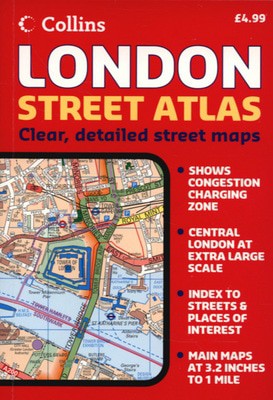
1:20,000 3.17 inches to 1 mile. 6.4 inches to 1 mile for central area (1:10,000). This handy little atlas features high quality Collins mapping. A huge amount of detail is contained within the mapping without compromising the clarity. Central London is mapped at a larger scale.
MAIN FEATURES
Extremely clear, attractive, full colour mapping with enlarged central area
Full index to place and street names
Theatres and cinemas map, plus shopping map
INCLUDES
Colour coded primary routes and public buildings
Street markets and pedestrian streets
Borough boundaries plus postal district boundaries and codes
AREA OF COVERAGE
Extends from Epping Forest in the north to Chessington in the south and from Heathrow in the west to Bexley in the east.
WHO THE PRODUCT IS OF INTEREST TO
This atlas, with its huge amount of detail and the clarity of the mapping is an essential purchase for all residents and businesses in and around London.
We are Rated Excellent on Trustpilot
Here's what you say about us...
We are Rated Excellent on Trustpilot
Here's what you say about us...
Type
BOOK
Edition
New edition
Keyword Index
Roads - England - London - Maps.|London (England) - Maps.
Country of Publication
England
Number of Pages
376