


Postcode atlas of Britain and Ireland
Title
Postcode atlas of Britain and Ireland
Postcode atlas of Britain and Ireland
format
Hardback
Hardback
Publisher
Collins
Collins
Language
English
English
UK Publication Date
20120105
20120105
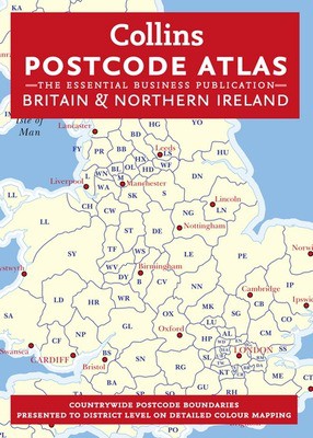
An essential business tool, this atlas clearly shows the postcode boundaries (down to district level) for the whole country on detailed colour mapping. In central London postcodes are shown to sector level.
Scale of main maps: 1:263,000 (4.15 miles to 1 inch).
MAIN FEATURES
This invaluable atlas shows postcode areas and districts for the whole of the UK and has been updated with all the latest boundary changes.
INCLUDES
Postcode areas (e.g. SW) and postcode districts (e.g. SW8) for the whole of the UK.
Postcode sectors (e.g. SW8 4) for Central London.
Busy conurbation areas at an enlarged scale of 1.6 miles to 1 inch.
Information on the structure and uses of postcodes.
Full colour map and a gazetteer listing of the administrative areas incorporating administrative changes that occurred in April 2009.
Full index to place names.
Index to postcode abbreviations.
Comprehensive background map detail which means the atlas can also be used for route planning and navigation.
AREA OF COVERAGE
Covers the whole of Britain and Northern Ireland.
WHO THE PRODUCT IS OF INTEREST TO
This atlas is aimed at the business user who will find it an invaluable tool for many applications including market analysis, distribution planning and sales territory organisation.
We are Rated Excellent on Trustpilot
Here's what you say about us...
We are Rated Excellent on Trustpilot
Here's what you say about us...
Type
BOOK
Edition
New Edition
Keyword Index
Postal codes - Great Britain - Maps.|Postal codes - Northern Ireland - Maps.|Great Britain - Maps.|Northern Ireland - Maps.
Country of Publication
England
Number of Pages
224