


M25 Master London street atlas - HarperCollins
Title
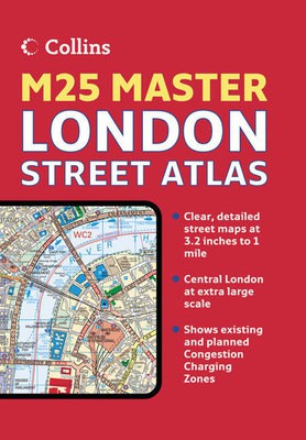
M25 Master London street atlas
M25 Master London street atlas
Author
HarperCollins
HarperCollins
format
Hardback
Hardback
Publisher
Collins
Collins
Language
English
English
UK Publication Date
20061204
20061204
Scale: 1:20,000, 3.2 inches to 1 mile, 1:10,000 6.3 inches to 1 mile.
Attractive atlas covering the whole of the M25 area. A huge amount of detail is included with a high level of clarity. Presented as a durable hardback.
MAIN FEATURES
Detailed street atlas covering the whole of the M25 London orbital motorway area at 3.2 inches to 1 mile. There is an extended area of central London stretching from Kensington Gardens to Greenwich at the extra large scale of 6.3 inches to 1 mile. It has a wealth of detail but retains its clarity and has a fine grid system making it extremely easy to use.
INCLUDES
Colour classified roads and buildings.
Postal district boundaries.
Car parks, hospitals and police stations.
Places of interest.
AREA OF COVERAGE
Extends from Brookmans Park in the north to Redhill in the south and from Slough in the west to Gravesend in the east.
WHO THE PRODUCT IS OF INTEREST TO
Especially designed for those living in and around the London area as well as business professionals.
We are Rated Excellent on Trustpilot
Here's what you say about us...
We are Rated Excellent on Trustpilot
Here's what you say about us...
Type
BOOK
Edition
New Edition
Keyword Index
London (England) - Maps.|London Orbital Motorway (England) - Maps.
Country of Publication
England
Number of Pages
352